


The Line of Control (LoC), a term that has become synonymous with the long-standing conflict between India and Pakistan over Kashmir, remains one of the most heavily militarized borders in the world. Stretching across the picturesque but contested landscapes of Kashmir, the Line of Control (LoC) is not only a geographic boundary but a symbol of the region’s fractured political, social, and cultural identity. As Kashmir continues to face tensions, border skirmishes, and humanitarian challenges, understanding the historical, political, and military significance of the LoC becomes essential for anyone seeking to grasp the complexity of the Kashmir dispute.
In this article, we delve into the origins of the LoC, its significance, and its role in the ongoing conflict between India and Pakistan, with a focus on the implications for the Kashmiri people living along its volatile edge.
What is the Line of Control?
Help us expose the truth
The Azadi Times is funded by readers like you. No corporate sponsors. No government influence. Just fearless reporting.
The Line of Control (LoC) is a military-controlled demarcation line that separates Indian-administered Jammu and Kashmir from Pakistan-administered Azad Kashmir. It is not an international border but rather a de facto boundary that emerged as a result of the 1947 partition of British India and subsequent wars fought between India and Pakistan. The LoC serves as the frontline of the Kashmir conflict, dividing families, communities, and territories that share a common cultural and historical heritage.
The LoC was established after the 1947-1948 conflict between India and Pakistan, following the partition of British India. At the time, both countries claimed the entire region of Jammu and Kashmir. The line was first laid out as the Ceasefire Line (CFL) after a United Nations-mediated ceasefire in 1949. However, the term “Ceasefire Line” was later changed to “Line of Control” after the Simla Agreement of 1972 between India and Pakistan.
The Length of the Line of Control
The Line of Control stretches for approximately 740 kilometers (460 miles) from the north in the icy heights of the Siachen Glacier to the south, where it ends at the Rann of Kutch. The LoC cuts across some of the world’s most challenging terrain, including mountains, dense forests, rivers, and valleys, making it difficult to navigate, both for the military and civilians. This rugged geography contributes to the difficulties in maintaining peace and stability along the line.
Due to its length, the LoC spans several strategic regions, including Poonch, Rajouri, Kupwara, Jammu, Baramulla, and Srinagar on the Indian side, and Muzaffarabad, Rawalakot, Kotli, and Mirpur on the Pakistani side. These areas are not only militarized zones but also home to tens of thousands of Kashmiri civilians who face the constant threat of cross-border firing, shelling, and military incursions.
When Was the Line of Control Formed?
The LoC as we know it today was formally established in the aftermath of the Simla Agreement of 1972, which followed the Indo-Pakistani war of 1971. This war led to the creation of Bangladesh and a shifting of political and military alliances in South Asia. The Simla Agreement stipulated that the Ceasefire Line, which was originally created by the United Nations, would henceforth be referred to as the Line of Control (LoC).
The Simla Agreement marked a turning point in the Kashmir conflict as both India and Pakistan agreed to respect the LoC and work towards a peaceful resolution of the dispute, although this has not been fully realized in practice. Despite the agreement, the LoC remains a contested and volatile region, often witnessing skirmishes, military engagement, and violations of ceasefire agreements.
Which Agreement Renamed the Ceasefire Line to the Line of Control?
The Simla Agreement of 1972 is the key agreement that officially renamed the Ceasefire Line to the Line of Control. Under the agreement, both India and Pakistan agreed that the LoC would serve as the de facto boundary between the two countries in the Kashmir region, without prejudice to the final status of Jammu and Kashmir. Importantly, both nations pledged to respect the line and avoid any military escalation or violation of its integrity.
Despite this, the agreement’s implementation has been marked by intermittent violations and clashes, particularly after the Kargil conflict in 1999, when both sides engaged in full-scale military operations in the Kargil sector, which lies along the LoC.
The Purpose of the Line of Control
The primary purpose of the Line of Control is to act as a military demarcation separating Indian-administered Jammu and Kashmir from Pakistan-administered Azad Kashmir. Its creation was an effort to halt the military confrontations that had begun in 1947 and escalated over the years. While it was meant to be a temporary measure until a final resolution of the Kashmir dispute could be achieved, it has remained in place for over seven decades.
The LoC serves as both a symbol of division and a frontline in the ongoing military standoff between India and Pakistan. It also serves a political purpose, as both countries continue to claim sovereignty over the entire region of Jammu and Kashmir. This disputed status means that while the LoC may represent a boundary on the ground, it is not recognized as an official international border.
Where is the Line of Control Between India and Pakistan?
The Line of Control divides the Indian-administered region of Jammu and Kashmir from the Pakistani-administered region of Azad Kashmir. It stretches through the Himalayan range, passing through a series of mountain passes, valleys, and rivers, many of which are strategic military locations. The LoC cuts across significant areas like Poonch, Kupwara, Baramulla, and Jammu in India, while in Pakistan, it passes through Muzaffarabad, Bhimber, and Mirpur.
On the Indian side, towns like Srinagar, Poonch, and Rajouri are located near the LoC. On the Pakistani side, cities like Muzaffarabad and Rawalakot lie in proximity to the line. Despite the militarization of both sides, many civilians continue to live in these border towns and villages, enduring the constant threat of cross-border firing and artillery shelling.
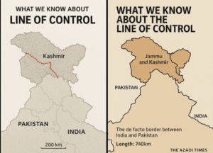
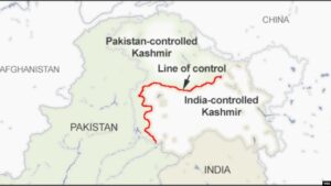
Line of Control Map: A Visual Representation
For those unfamiliar with the geography of the region, a Line of Control map can provide a clearer understanding of where the LoC lies and how it divides the Kashmir region. Maps of the LoC often highlight the key military positions and terrain features that make the region both strategically important and vulnerable to conflict.
The LoC map also shows areas of territorial dispute, especially in regions like Siachen, where the world’s highest battlefield is located, and Kashmir’s northernmost areas, which have been a flashpoint for tensions between India and Pakistan.
The Human Cost: How the LoC Affects Kashmiris
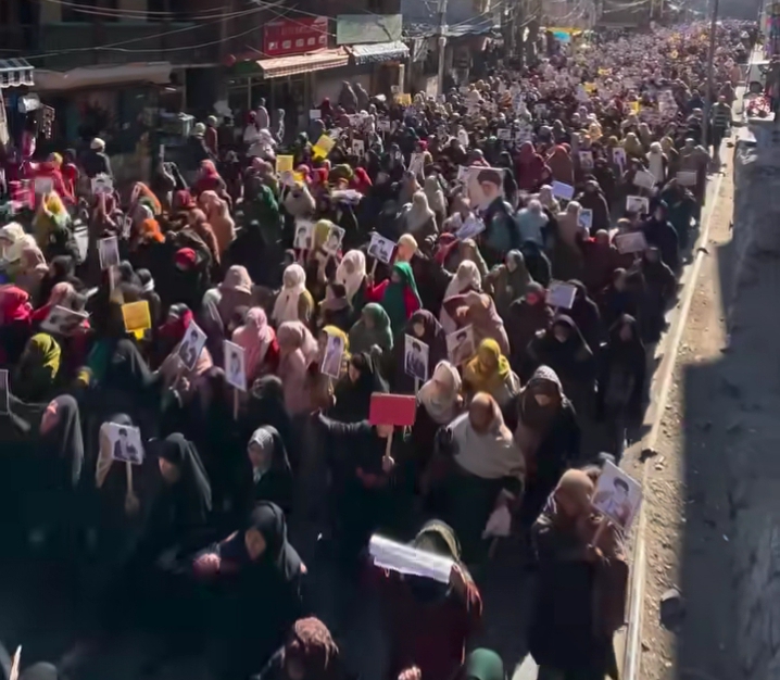
For the people of Kashmir, the Line of Control is much more than a geographical boundary; it is a line that separates families, communities, and lives. Millions of Kashmiri families have been divided by the LoC, with loved ones living on opposite sides of the border. Cross-border firing, shelling, and militancy often disrupt daily life, leading to casualties, displacement, and trauma.
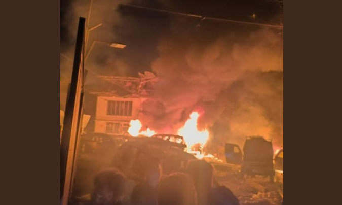
Kashmiris living along the LoC face constant disruptions in their lives, from the destruction of homes and businesses due to artillery shelling to the psychological toll of living in a war zone. Children grow up with the sound of gunfire, while farmers and shopkeepers find their livelihoods destroyed in the wake of military confrontations.
Conclusion: The Line of Control and the Road Ahead
The Line of Control remains a physical and symbolic dividing line in the Kashmir conflict. Despite multiple efforts at peace and dialogue, the LoC continues to be a flashpoint of military tensions and political disagreements between India and Pakistan. The human cost of this unresolved dispute is borne by the people of Kashmir, whose lives are shaped by the uncertainty and violence that accompany living in the shadow of the LoC.
As the world watches, the future of the Line of Control — and the larger Kashmir dispute — remains uncertain. Peace may remain elusive, but for the people of Kashmir, the hope for resolution, dignity, and self-determination endures.
